Use APKPure App
Get Great Divide Trail old version APK for Android
Detaillierte, kartenbasierte Wanderführer für die Great Divide Trail
Please download "Guthook Guides: Hike & Bike Offline" to access the Great Divide Trail guide. Existing customers may transfer their purchases to the Guthook Guides: Hike & Bike Offline app. This app is no longer supported and will be removed from the Play Store October 2019.
Great Divide Trail is a GPS- and map-based guide for your hiking trip on Canada's majestic 1,120-km (700-mile) Great Divide Trail. The Great Divide Trail stretches from the Canada-U.S. border at Waterton Lakes National Park, Alberta, through the Canadian Rocky Mountains to Kakwa Provincial Park in British Columbia.
The free demo for the Great Divide Trail covers the 25-km portion from its southern terminus at the Canada-U.S. border in Waterton Lakes National Park to Cameron Lake, Alberta.
In-app purchases include guides for:
Entire 1,120-km Great Divide Trail
- GDT Section A
- GDT Section B
- GDT Section C
- GDT Section D
- GDT Section E
- GDT Section F
- GDT Section G
Key features:
- No mobile or internet connection is required after initial setup -- works in Airplane Mode
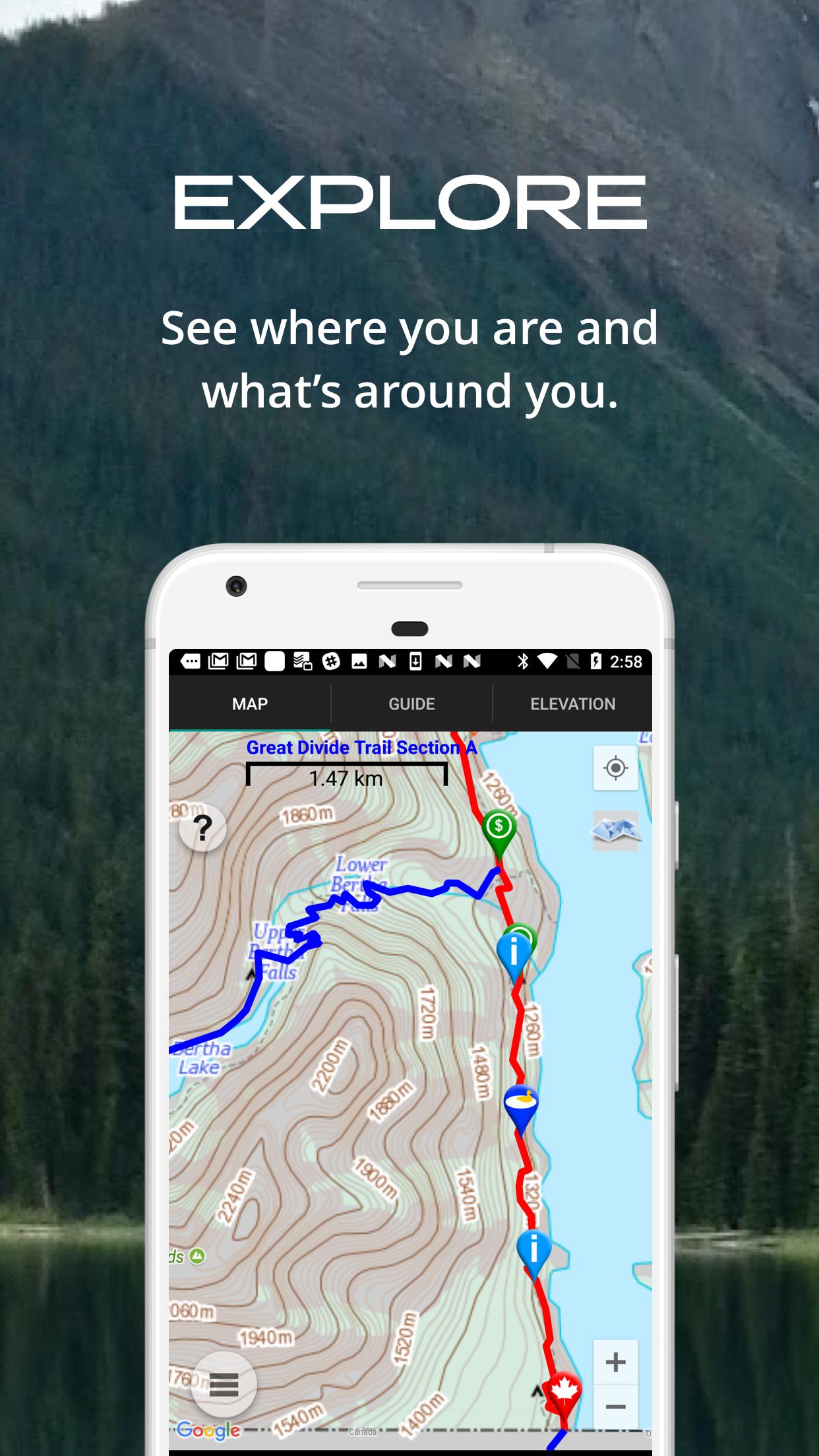
- Detailed maps with your GPS location
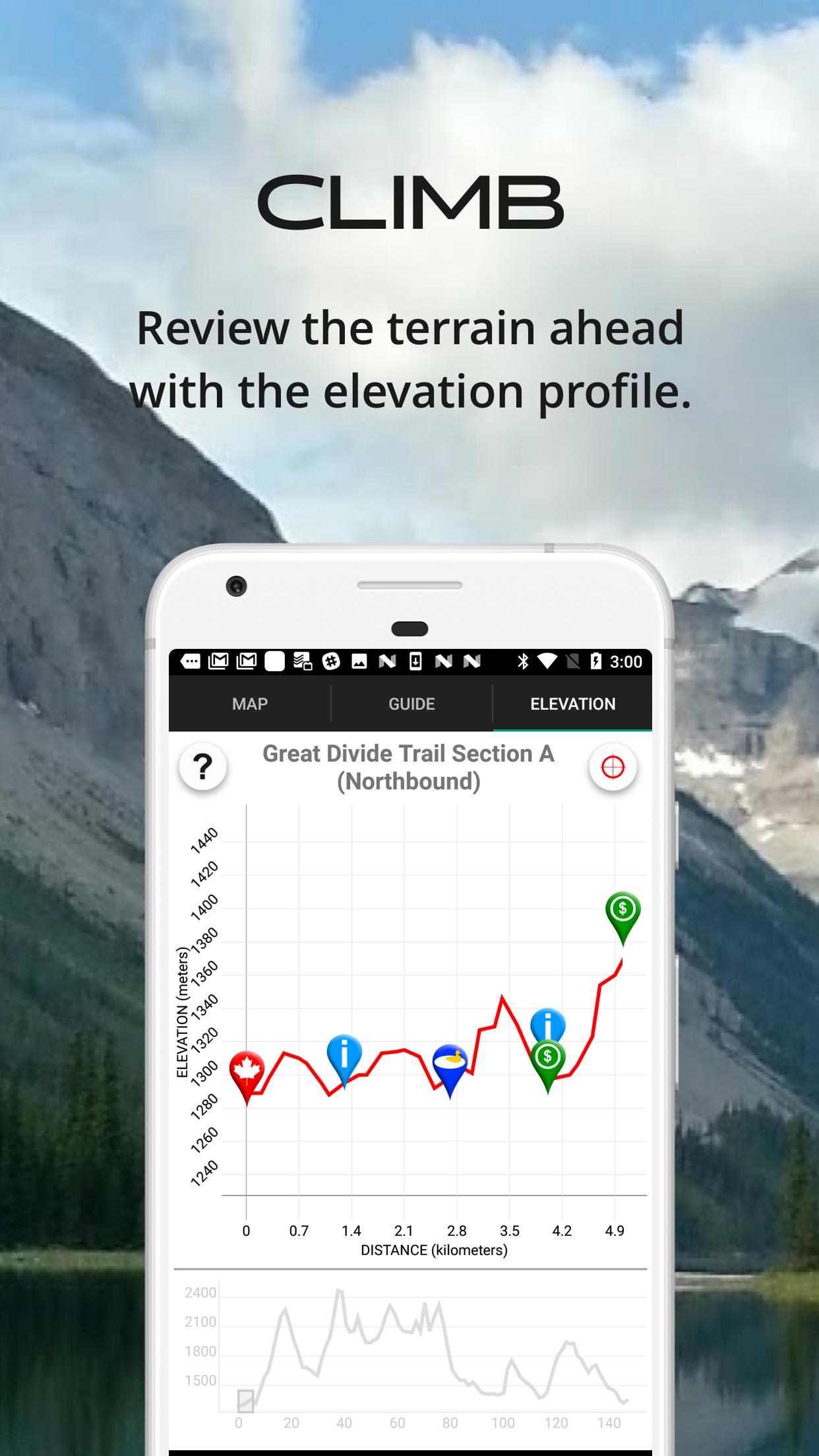
- Elevation profile view
- Custom route creator
- Multiple offline map choices
- Real-time comments from other hikers
- Send your current location to friends or family via text message or email
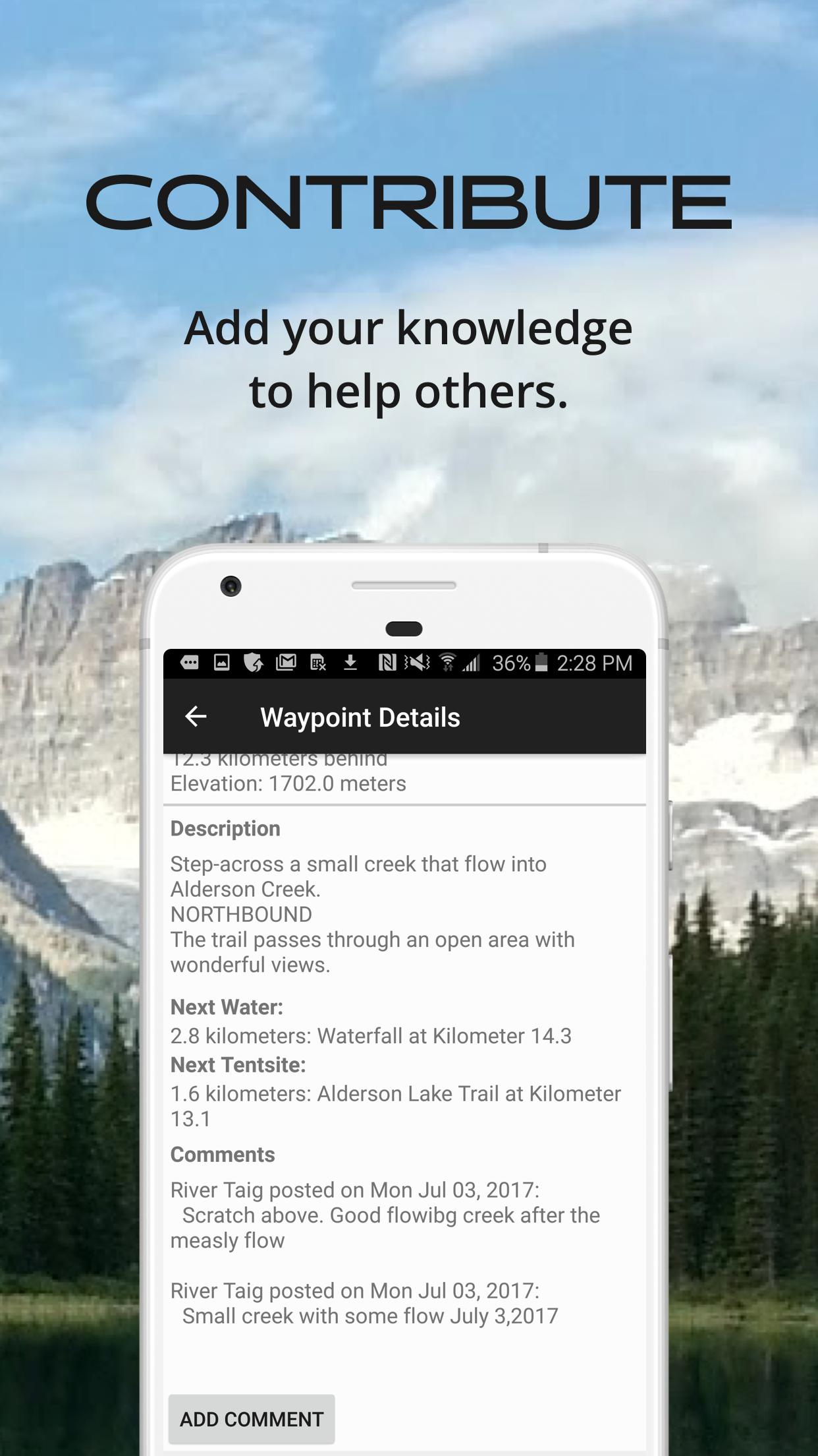
The guidebook lists every waypoint in order by distance along the trail and how far away you are from each waypoint. The guidebook also includes a detailed town guide for major resupply points, towns, and services along the GDT.
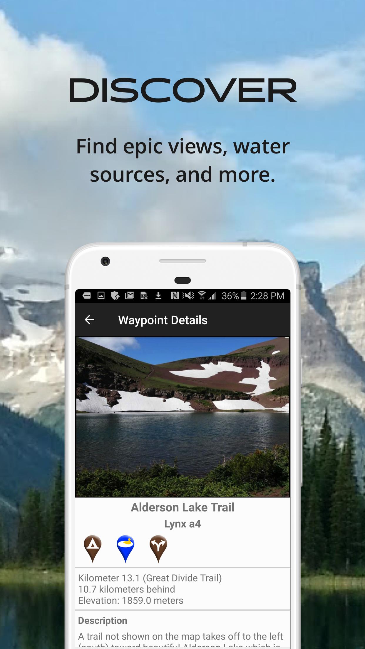
Waypoint details include:
- Mileage point and elevation
- Photographs
- Distance to the next water source and tent site
- Comments section where you may post comments and read other hikers’ comments
Types of waypoints:
- Water sources (including the reliability of each water source)
- Detailed resupply and town information:
- post offices and other package services
- restaurants
- grocery stores and convenience stores
- gear shops and hardware stores
- laundromats
- lodging, public showers, public restrooms
- public libraries
- Tenting sites/camping sites
- Trail junctions
- Parking areas along the trail
- Picnic areas, campgrounds, ranger stations
- Roads, railroad tracks, power lines, fences, gates
- Natural landmarks (e.g. mountain passes)
- Privies/restrooms
- Views
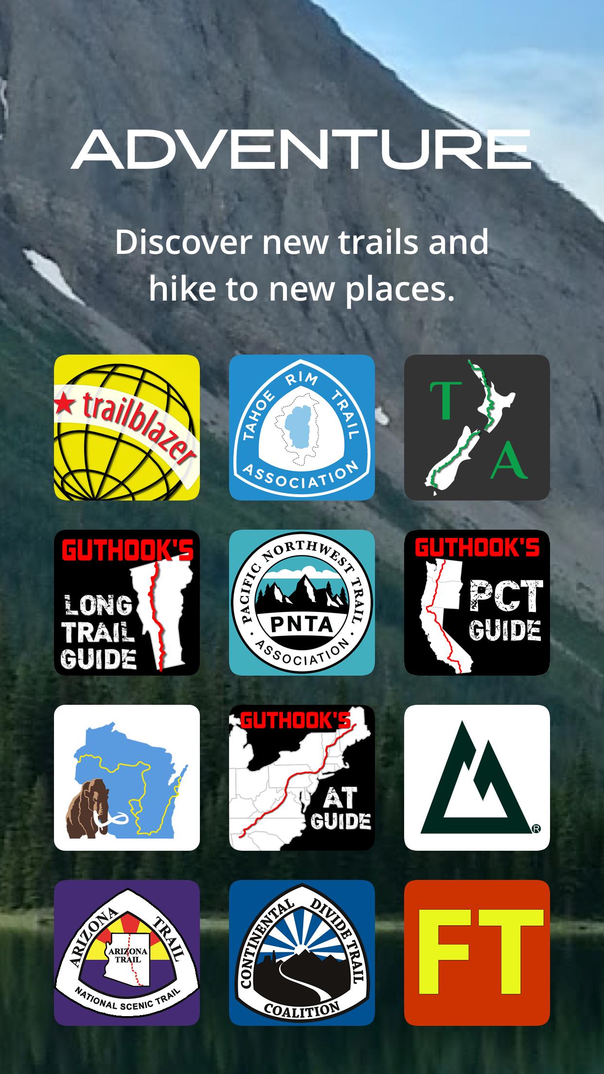
Related apps: The southern terminus of the Great Divide Trail connects to the northern terminus of the Continental Divide Trail, a 3,100-mile trail that stretches the entire length of the United States from Canada to Mexico. Check out our CDT Hiker: Guthook's Guide app to continue your GDT adventure southbound.
Last updated on Oct 25, 2019
Update to backend management
Aktuelle Version
![]() 7.2.00
7.2.00
Von hochgeladen
Nicky Infinity
Erforderliche Android-Version
Android 4.2+
Kategorie
Bericht
Discover what you want easier, faster and safer.

Great Divide Trail
7.2.00 by AtlasGuides
Oct 25, 2019