下載 APKPure App
可在安卓獲取LACO-Wiki Mobile的歷史版本
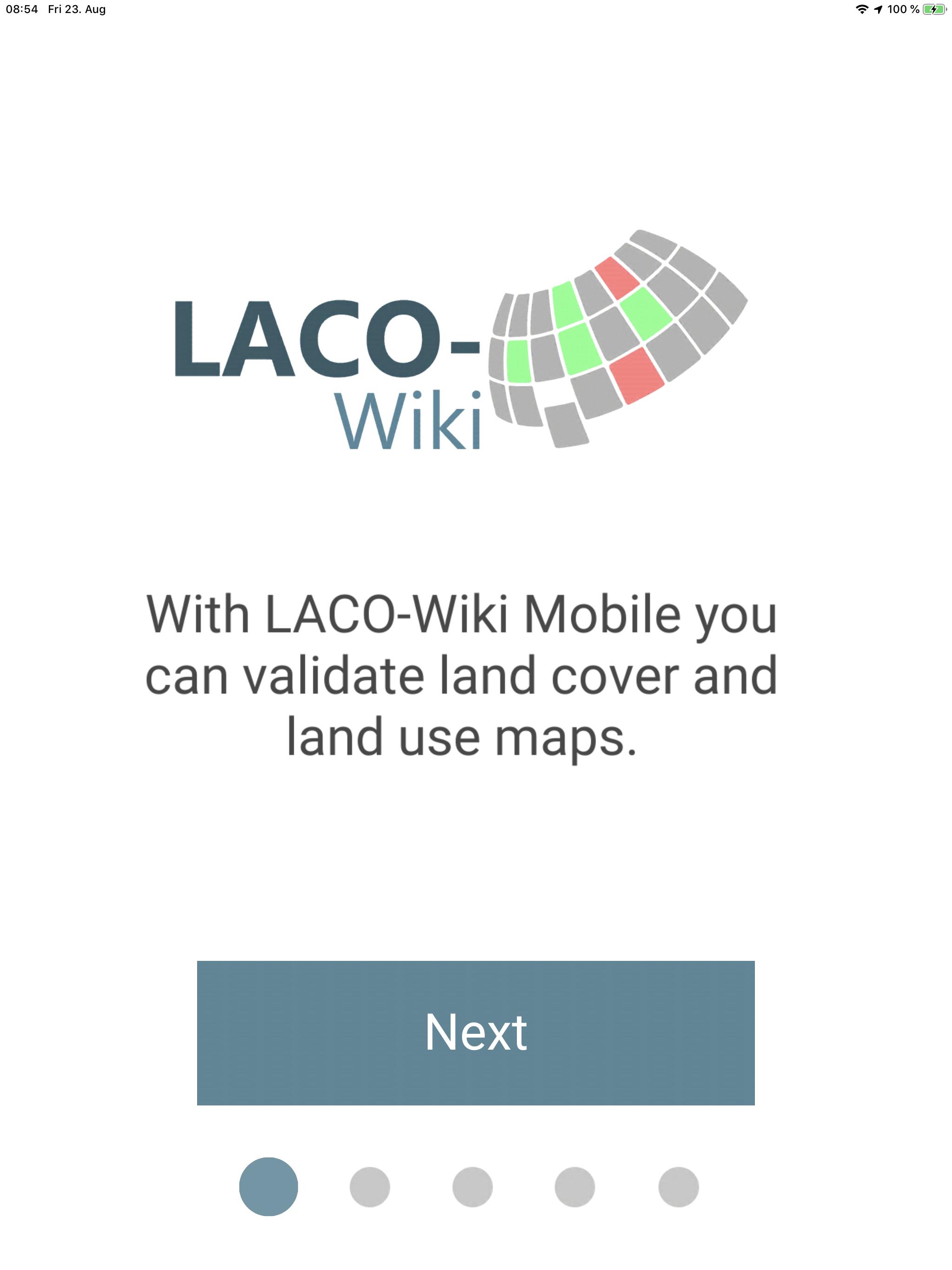
驗證土地覆蓋和土地使用地圖
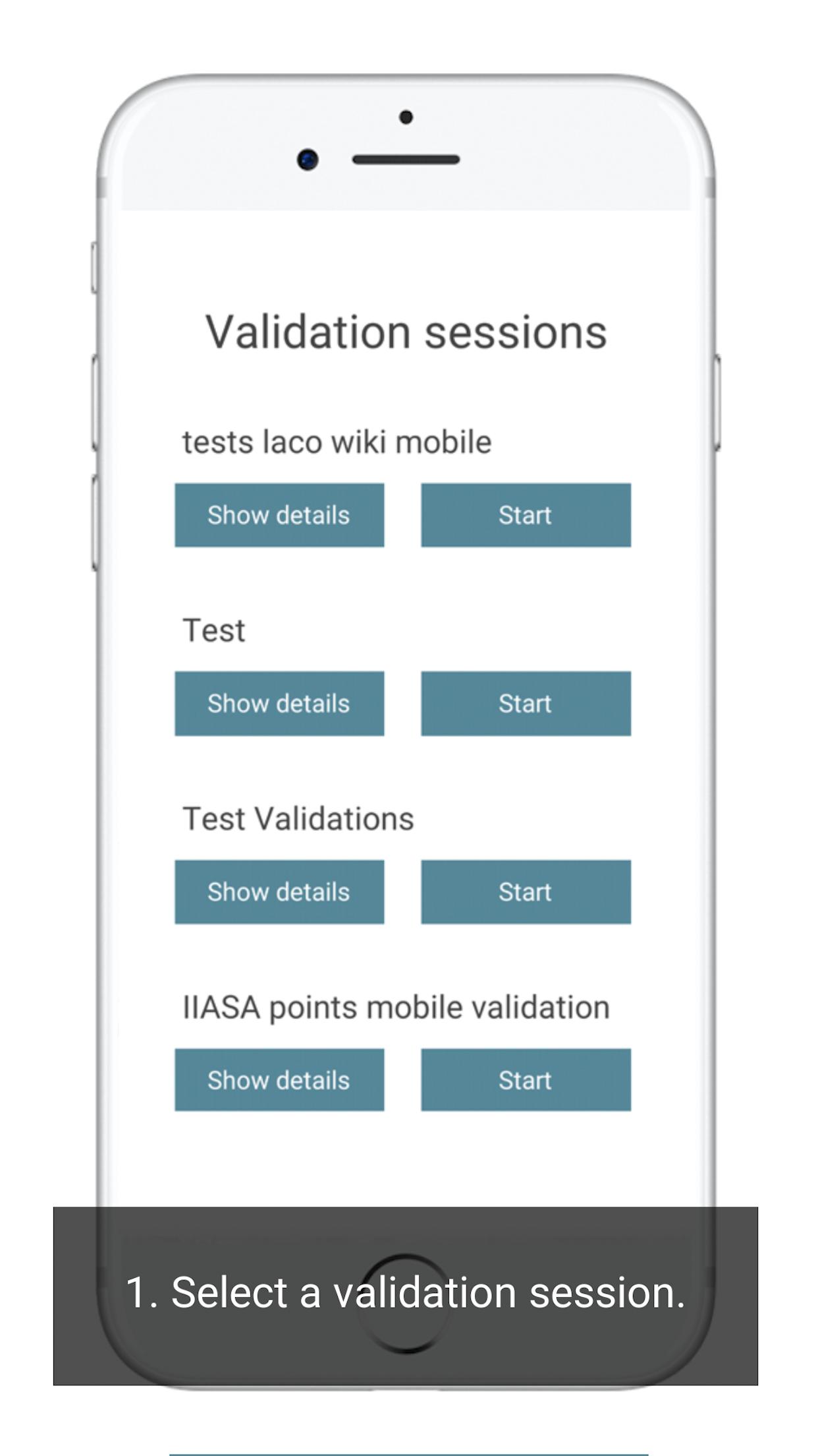
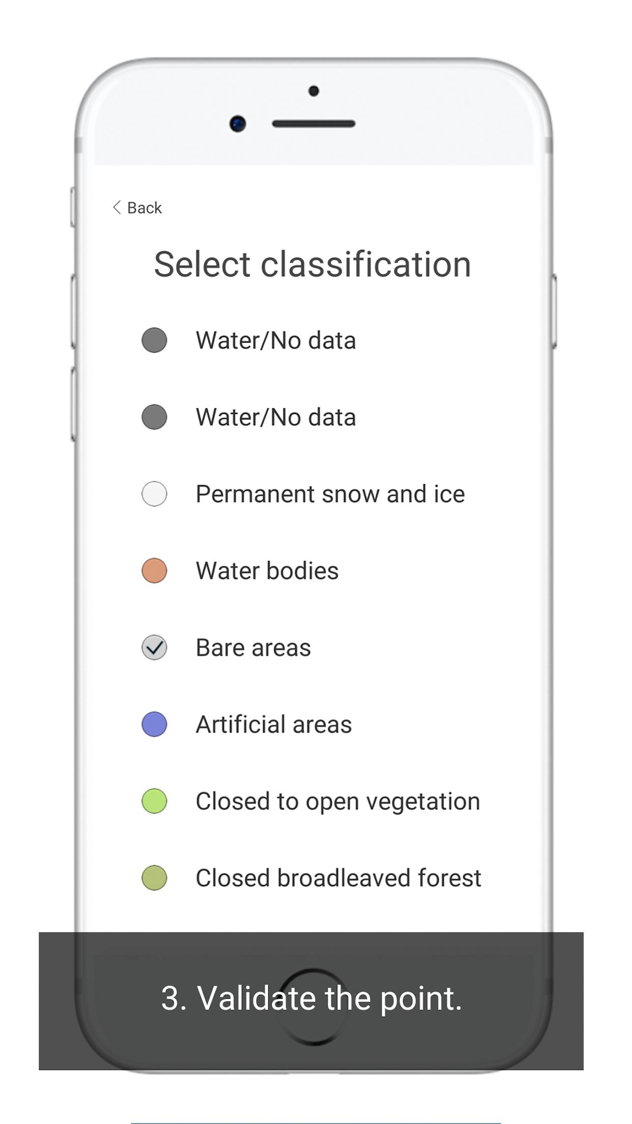
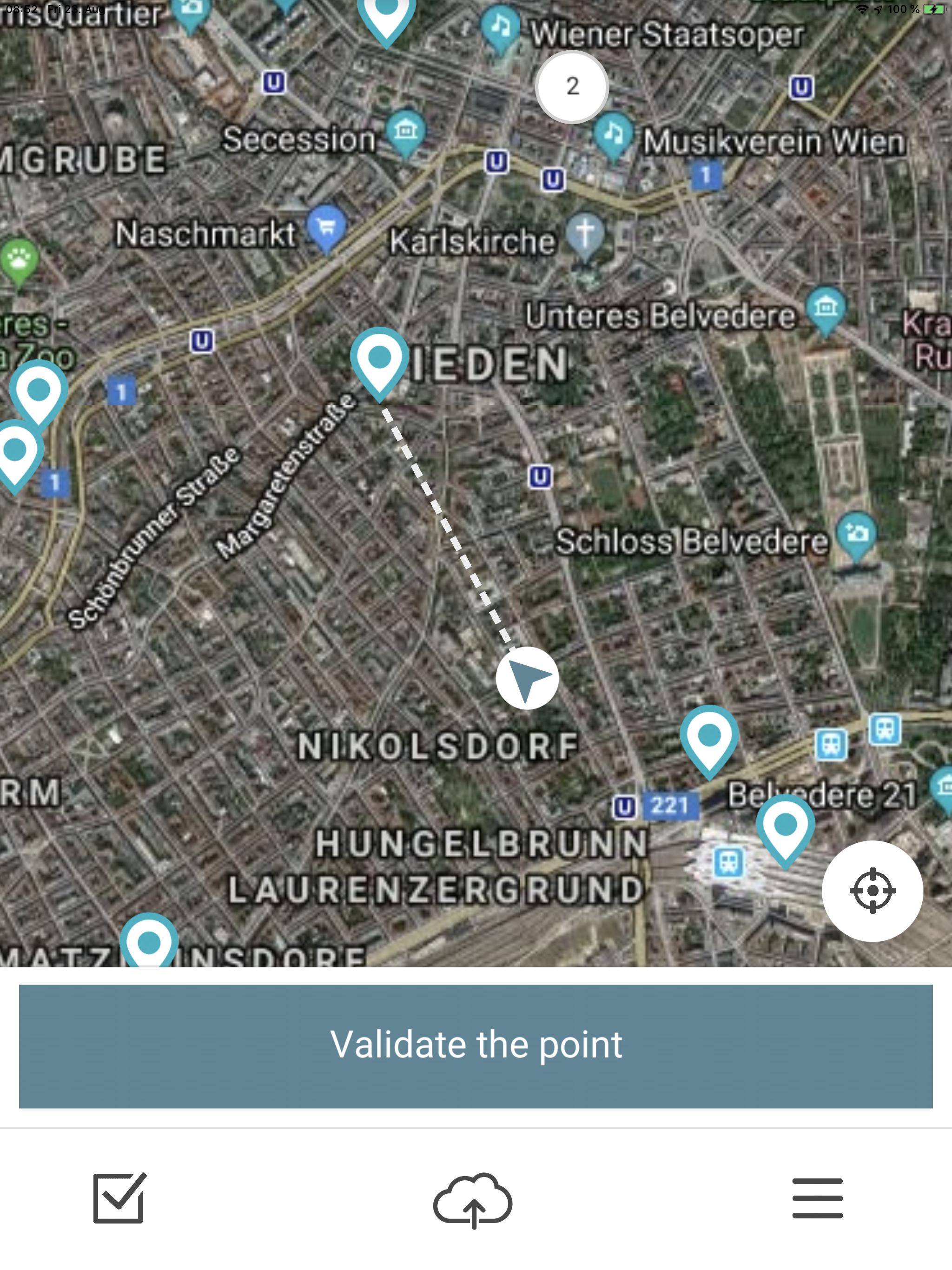
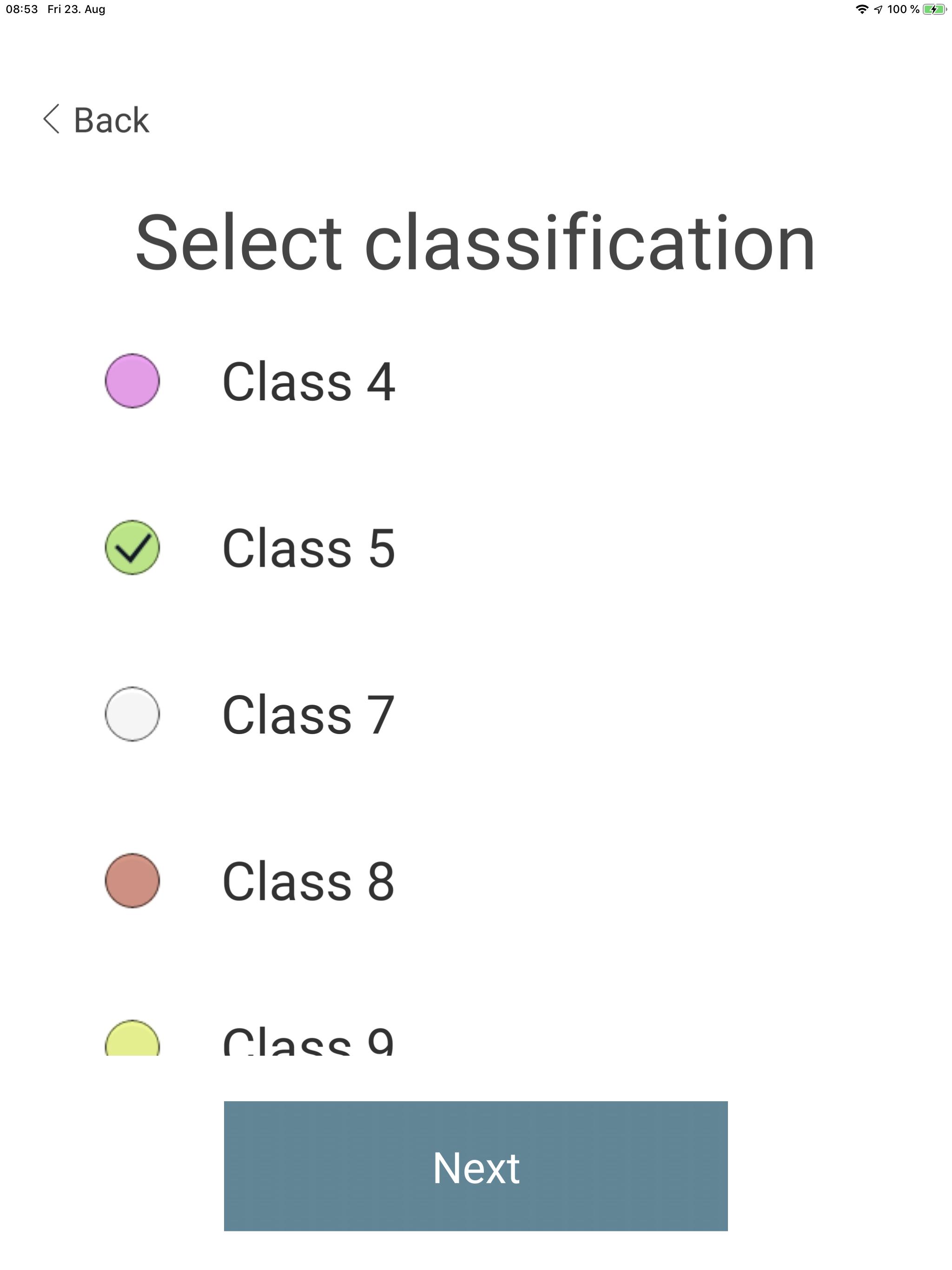
With LACO-Wiki Mobile, you can collect data on land cover, land use, crop types or any physical phenomenon in the field. The mobile app works in tandem with the online version of LACO-Wiki (https://laco-wiki.net), which is an online land cover validation tool. In LACO-Wiki, you create a sample (random, stratified or systematic) from an existing land cover/land use/crop type map and then you send the sample to the mobile phone. In LACO-Wiki Mobile, you are then directed to these sample points on the ground to verify the land cover (land use, crop types, etc.) using the classes specified in LACO-Wiki, with the option to add geo-tagged photographs.
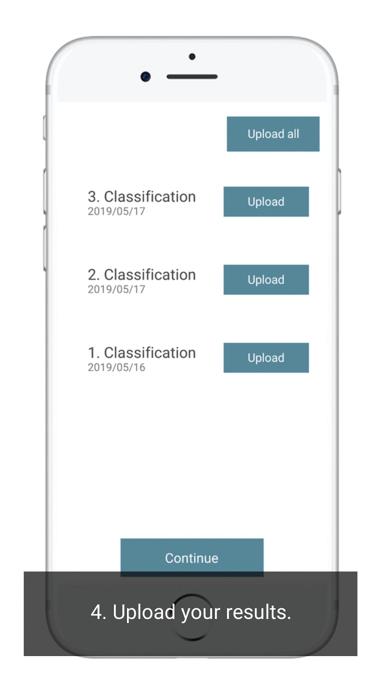
In addition to being directed to specific sample locations, you can also collect data on land cover (land use, crop types, etc.) at any location in the field, which can enhance the sample. Once you have collected the data, you can upload it to the LACO-Wiki server and produce an accuracy assessment of your land cover (land use, crop type) map.
An added feature of LACO-Wiki is the ability to create a sample along an existing road network in order to make the data collection easier/more cost effective.
Last updated on 2020年10月17日
Plausibility validation and Enhanced Plausibility validation methods added.


LACO-Wiki Mobile
1.52 by Geo-Wiki Apps
2020年10月17日